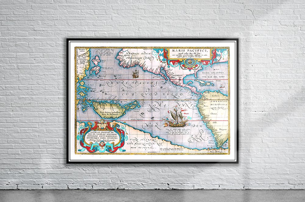
Ortelius’s 1570 map of the Americas from the Theatrum Orbis Therarum, the world’s first atlas. The Straits of Magellan, discovered by the Portuguese navigator on 1 November 1520, are shown between South America and the large southern continent (Modern day Antarctica). Stunning Full Colour Reproduction using the Most Advanced Technology Available Printed on Museum Matte Archival Paper 310gm Unique Conversation Piece for your Home or Business Frame not included