MUNDOMINIJUEGOS.ES ≡ Archive Sweets Pick N Mix Accessories Face Cleansing Gel
  • The Americas

  • Vintage Map of New France 1755

Vintage Map of New France 1755

$45 $72.45
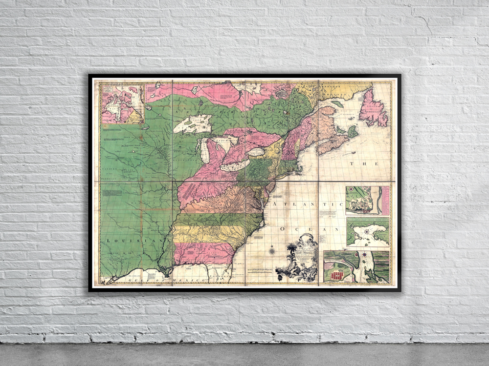
A map of the British and French dominions in North America by John Mitchell in 1755. Prepared on the eve of the French & Indian War, it was the second large format map of North America printed by the British, and included the most up to date information of the region. Stunning Full Colour Reproduction using the Most Advanced Technology Available Printed on Museum Matte Archival Paper 310gm Unique Conversation Piece for your Home or Business Frame not included
The Americas

The Americas

  • Vintage Map of The Chicago Great Fire 1871
    $45 $54.9
  • Vintage Map of Tennessee 1862
    $45 $54
  • Vintage Print of Washington D.C. 1871
    $45 $83.7
  • Vintage Map of South America 1734
    $45 $71.55
  • Vintage Map of South America 1715
    $45 $55.35
  • Vintage Map of The Americas 1730
    $45 $54.9
  • Vintage Map of North America 1720
    $45 $78.75
  • Vintage Map of Florida 1806
    $45 $73.8
  • Vintage Map of New France 1720
    $45 $58.5
  • Vintage Map of Pacific Ocean 1590
    $45 $72.9
  • Vintage Map of South America 1623.
    $45 $85.95
  • Vintage Map of Virginia 1630
    $45 $67.95
  • Vintage Map of The Americas 1720
    $45 $89.1
  • Vintage Map of New France 1755
    $45 $72.45
  • Vintage Map of New England 1673
    $45 $73.35
  • Vintage Print of San Francisco 1846
    $49.5 $93.06

© 2026 - MUNDOMINIJUEGOS.ES