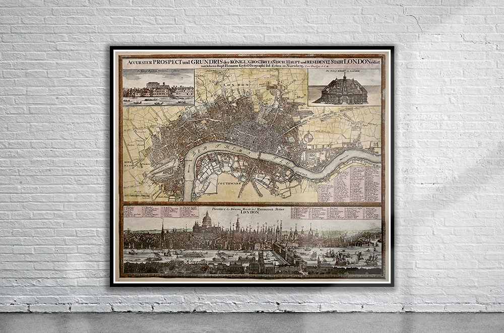
Johann Baptist Homann’s Map of London from 1730. To the upper left of the plan is a of the Palace of Whitehall – the royal residence in the seventeenth century; to the upper right is a view of the Royal Exchange, which had been rebuilt by Edward Jarman, after the previous one had been destroyed in the Great Fire. Below left is a list of streets, churches and public buildings. Stunning Full Colour Reproduction using the Most Advanced Technology Available Printed on Museum Matte Archival Paper 310gm Unique Conversation Piece for your Home or Business Frame not included